
3am sees me padding around another sleeping hotel – breakfast has been left out at reception as promised, although it takes me a few moments to figure out the latch on the low wooden door to get behind the desk,. The bag is wet in one corner – the culprit, a large dill pickle, slips out of the hole as I pick it up. Bizarre as it sounds, pickles are a well known aid for cramp, although I’m fairly sure it’s inclusion is just a coincidence of regional cuisine. I rescue the pickle, and stuff it in my mouth, putting the rest of the food bag in my musette.
As the basement door opens to the garage I’m greeted by the tracker lights, still flashing away exactly where I had last seen them. I perform a full reset on the tracker though as I kit up – I learned on the Cape 1000 that it doesn’t always come out of sleep mode after a prolonged lack of satellite signal. I’ve eaten a substantial part of the breakfast by the time I wheel back up the ramp and the garage door swings shut behind me. At this point, I still have my key and can get back in if I’ve forgotten anything. I’m rather more nervous though in the lobby, and double check everything before I drop the key at reception and the front door closes behind me.
HEITLERN, 813km – 3:25AM (race clock 03d // 05H // 25M)
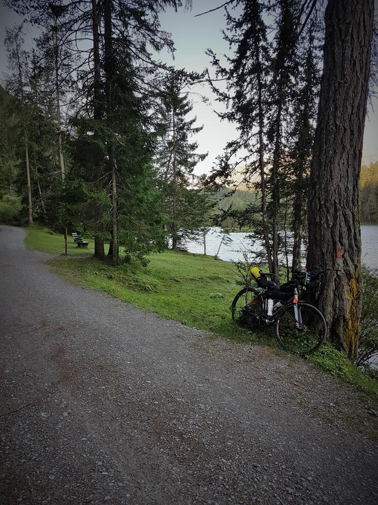
The streets are empty and there’s no traffic as I roll along in the dark morning at the start of my 4th day on the road. There’s a breeze – it doesn’t really hamper my progress, but it’s chilly enough to see me putting my gilet on. I must have missed the actual border sign, because the sign I do stop at to record my passage into Austria is one of those large pictorial summaries of road laws. It’s a little disappointing, but I guess an incomplete set of border photos isn’t the worst thing that could happen – the tracker log will still show I went across them. Somewhere midway between towns, I start hearing a faint, high pitched whistling. I’m wondering if some gadget on my bike is 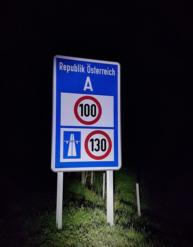 making a warning sound, but it appears to be alongside me rather than on the bike. And then I spot it – as I pass each of the reflective posts that mark the edge of the path, they sing out at me. Whether it is my light or a proximity sensor I’m not sure. The only explanation that comes to mind is maybe some aid for partially sighted people walking on the path.
REUTTE, 831km – 4:20AM (race clock 03d // 06H // 20M)
I travel through the middle of a sizeable town, beyond which is a long sprawl of houses and business. At the end of these I come to a junction that I’ve both been expecting, and fearing. This is the start of Fern Pass, the first of two big passes which will hopefully see me across and out of the Alps today. I’d joked with Yoli yesterday that she could call me Hannibal, lugging my elephantine rig through the mountains. What’s in front of me is a confusing sight though. There’s a sign which seems to mean no pedestrians or cyclists. But does it refer to the end of the cycle path, or the road that carries on ahead, or the slip road leading right onto the actual pass?
Komoot and others had clearly shown the tracks of cyclists having ridden here, so I decide my interpretation must be off and roll up the slip road anyway. The dotted lines at the junction give way to a solid white line as the slip road merges onto the main pass. There’s just one lane for traffic each way, and the solid white line is right up against the Armco barrier – there’s nowhere to ride but on the main road. As I survey the route, a truck thunders past at what feels like at least 100km/h. I’ve barely had time to assess what I’m seeing before another one hammers past. I made one promise to Yoli before leaving for TCR – that I wouldn’t take any undue risks with my health or safety. Slogging up a pass in the dark at 15km/h with traffic approaching me from behind travelling 80km/h faster does not feel like I’d be honouring that promise.
I know it’s the right thing to do, but as I wheel across the road and back down the slip road on the other side I am utterly lost for what to do next. And then, standing there dejected, my bike propped against a railing, a voice comes to me out of the dark. It’s not just a random voice, it’s the voice of Juliana Buhring from the race briefing last Friday:
“If you end up on a road that feels unsafe, even if it’s legal to ride, FIND ANOTHER WAY …”
Find another way – sure – but which other way? There’s no pass anywhere near where I am standing. It’ll be a huge backtrack and detour, and who knows if I happen to pick one just as bad. And then another part of the subtle, but thorough way the TCR organizers prepare you for this beast comes to my rescue. Somewhere in the race manual, which I’ve picked over word by word many times, is a passage from Mike about the importance of planning your own route rather than cribbing or sharing the process with others. The full value of those words now hit me like some divine inspiration from above. I remember maps showing the path of the Via Claudia Augusta, which shadows the modern road along the the same natural passage through the mountains. It’s an old Roman Road – much of which is now a cycle touring path. But I’d skimmed a few reports suggesting this section is much less sedate – more of a combination of steep gravel track, and occasionally full on mountain bike trail. It won’t be easy, assuming I can even find it in the dark, but it does lead from where I am now stood to where I need to get too. I begin zooming in the eTrex screen and scanning for clues (at the same time as kicking myself for not having plotted this as an option, to save the searching).
What was that?
I zoom out and in and scroll again, and there it is. An odd thin line marked with blue and black dashes, and the unmistakable words “VIA” at intervals along it’s wiggly length. That has to be it. I quickly ride back through the suburban sprawl until the line on screen veers diagonally left up a side street. Literally my whole TCR revolves around this next few hundred meters, and I’m holding my breath as I follow it. At the top of the street there’s a confusing set of signs marking walking trails. One of them shows a logo of a bridge with the stylized letters VIA in it’s span. It doesn’t seem to indicate quite the same direction as the GPS, but there’s no doubting that I’ve found the path. I decide to trust the GPS, and follow that. A little further along, the split joins together and I’m sure I’m on the right trail. That certainty comes with a mix of other emotions though. The first section is a steep, slippery gravel path up through dense woodland. It’s well lit, and easy to follow, but the gradient soon has me walking. I’m relieved, and also rather delighted by this unexpected slice of nature, but I know there’s going to be a heavy price in time for navigating this beautiful old way.
It isn’t all walking, at least not yet. The track opens onto road again through what seems like a medieval village. In the dark, it’s hard to know whether it’s some small locally themed tourist attraction (which it feels like), or whether maybe it’s some original part of the path – an inn for resting horses and troups, or maybe a toll gate of some kind. It turns out my hunch was not far off, this is in fact the old customs station of Klause, together with various old buildings rehoused to the site from nearby. It’s a little surreal and magical as I ride through it, silent and alone. Dawn creeps over the surrounding mountains and down into the forest, and the route alternates between road and ride-able forest tracks. Some parts are seriously challenging on a heavily loaded bike, but I’m impressed with how well the 30mm S-One tyres are handling. They were put on with the intention of being to handle the possibility of light gravel, but nothing this intense. On one corner I find myself alongside the Fern Pass proper. It’s quieter of traffic, or maybe it just looks less scary in the daylight, but either way it’s no more appealing. The section I’m alongside is at the mouth of a short tunnel. Even if I’d taken the road this far, I’d probably have been considering hopping the barrier over onto the track to where I am now. As well as being unpleasant and dangerous, tunnel’s are for the most part banned on TCR.
Heiterwang, 840km – 5:25AM (race clock 03d // 07H // 25M)
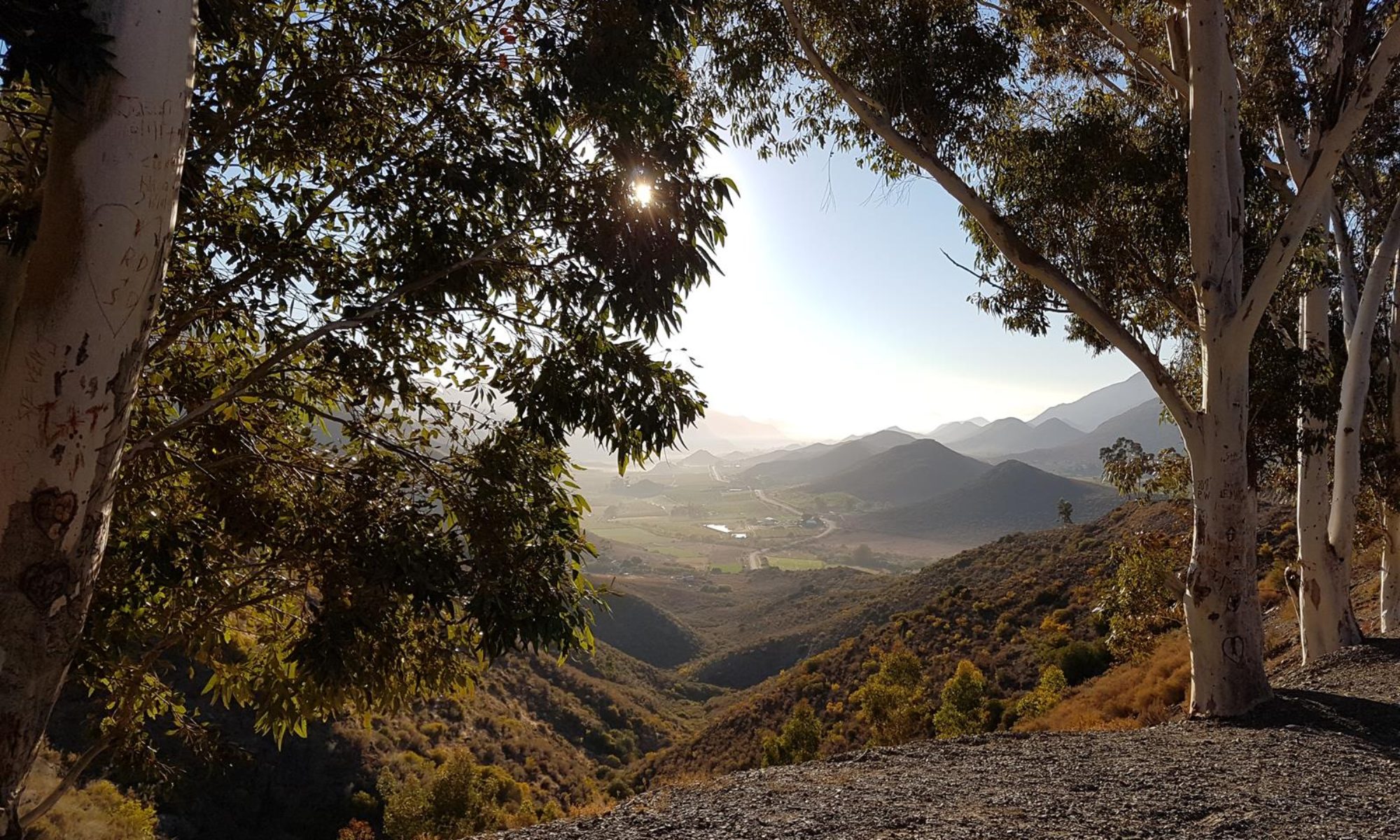
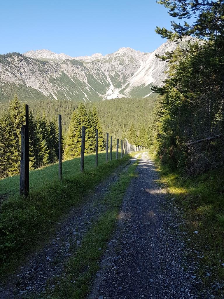
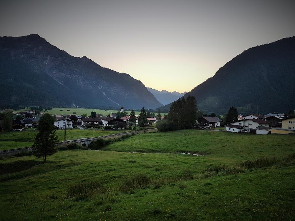 Just a couple of corners further along, I’m greeted by a truly magnificent sight. Verdant meadows spread out in front of me, rising on all sides up to steep pastures, woodland, and towering mountain peaks. Beyond the fields is a small chocolate box town, and beyond that a lake glistens bright blue in the morning sun. I have climbed up into the Alps (although it turns out I’m not as far through them as my mind imagines at this point). The GPS screen is confusing. The VIA itself is now a faint muddy track across a field. The road I am on runs down to my left and onto the main pass again, which not far ahead enters another tunnel. I ride down and take a look, but in the confusion of the junction I miss the fact that part of the road continues under Fern Pass and into the chocolate box town. Instead I end up on a sketchy farm track alongside the pass which I had spotted from my vantage point above. It soon becomes nothing more than two lines of stones, wheel width apart, with grass
 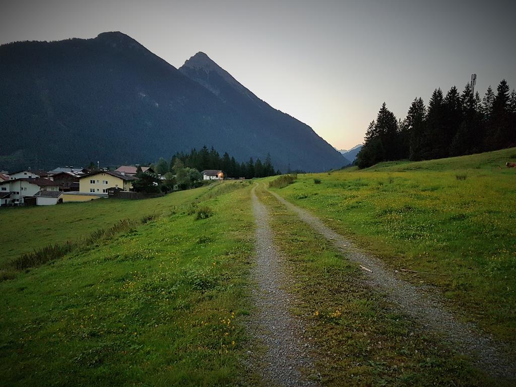 in between. At one point I have to duck under a wire fence, and the pasture I am riding across becomes quite literally the roof of the main pass which is burrowing its way through tunnels under my feet. I can’t resist a photo of the two gravel lines leading off into the distance – and a message about the “rush hour traffic” (mostly cows and the odd goat) on my version of the pass. At the far side of the pasture I’m finally back on a proper road, free-wheeling down into the town.
My sense of where I am is quite off by now. For some reason I think I’m already in Biberwier, and the route out of town initially seems to confirm this feeling. But it soon becomes a mix of cyclepath and rural lane which aren’t heading the way I expect. The riding is flat and easy though, and I’m making good speed so I push on. At the end of the flat stretch I reach a fast downhill stretch of gravel and mud track which follows the line of a stream. The bike handles impeccably, but I have to force my hands off the brakes and concentrate on picking a good line and letting the bike flow around and over rocks, tree roots, and other obstacles rather than trying to pick my way around each one. It’s exhilarating, and a little bit terrifying to be travelling so fast down something I’d normally choose a mountain bike to ride. My heart is pounding by the time I roll out onto tar road again at the bottom – but there’s also a huge smile on my face at having not just survived it, but having ridden it. There’s a hotel opposite with people sat at a table – I head over to see if I can score some coffee and breakfast.
Lermoos, 854km – 6:37AM (race clock 03d // 08H // 37M)
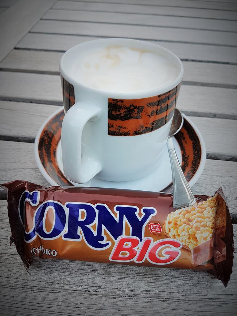 Coffee they have – and good coffee at that – but no food. I don’t understand everything the guys say (it sounds more Latvian than German), but the gist is that the hotel isn’t really open yet. The group it seems is maybe local workers , or hotel staff, having some get together before the start of the day. I’m grateful for the coffee, and even manage to wangle a second cup out of the chap who served me. I’ve got plenty of food with me to make my own breakfast, and I can’t resist the cereal bar I bought the night before – not least because the name is a long running joke with Yoli, and I know she’ll laugh at the photo. For some reason, I also end up visiting the garage opposite before rolling out – maybe for extra snacks, or perhaps I forgot to get water from the hotel
 I’m on tar, and briefly back on my original route. It’s not a busy stretch – the morning traffic hasn’t really got started yet. But the realisation soon hits me that I am now, actually in Biberwier – good news in the sense that I am making progress, but bad news because it means there is a big climb still to come. The tar weaves around the town, and reaches a 90 degree right hand bend which I have been expecting. On my original route this is where I’d decided I might opt for gravel if the pass looked too busy. Having seen the pass already, and got used to the gravel, it’s a no-brainer. I veer directly left onto the forest trail without even stopping. The trail is flat initially, with a good surface as it passes another
 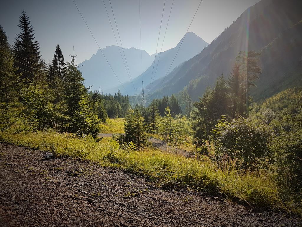 beautiful small lake. Beyond though it pitches steeply upward, the gravel becoming much more uneven, rocky, and loose. I manage to pedal some stretches, but there are long patches where I find myself walking. The track climbs ever higher, at times seeming to be far above the road pass below. Eventually though, it dips down and I mount up for the fast descent.
 Again, it’s a stretch I am intimately familiar with from studying maps. The track crosses under the road through what feels like an oversized sewer pipe. I have a choice of joining back onto the tar again – but I know that it’s largely downhill from here. Whilst the road probably won’t feel so bad with me making a better speed relative to the traffic, the forest track is going to be much prettier, and reasonably fast riding. It’s anything but easy though. The first section is another gentle track, with grass down the middle. But it soon pitches down sharply into a descent on loose gravel. The first part is so steep I struggle even to push down it. After that though, I
 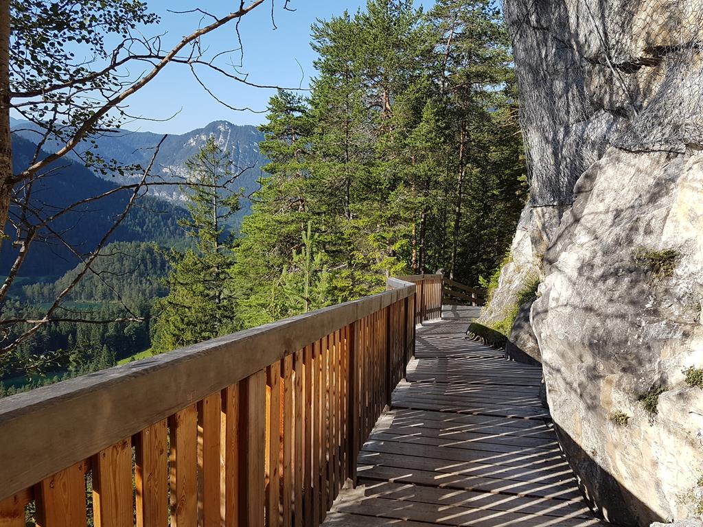 manage to stay mounted for most of the riding. At some point the path follows a narrow wooden platform around a rock, beyond which it drops down onto proper single track, twisting down through woodland. Terror would not be too much to describe much of what I feel as I hang on and rip down it. But as with the earlier stretches, the combination of sublime natural scenery, and managing to somehow survive it fills me with an intoxicating mix of awe and satisfaction.
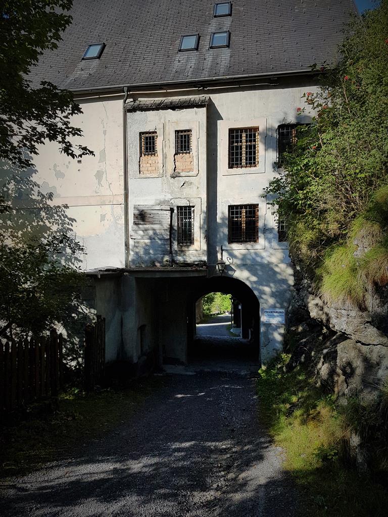 I pass under another old building of some kind, which also seems to have been a toll house or border post. Various slightly tatty signs adorn the doors to suggest it may now be a hostel of some kind, but it looks completely shuttered and deserted (these buildings are marked on the map as Fernstein, although the inhabited part of the hotel is a bit further away). I roll on, and before long come out onto a small tar lane. I zoom out the Garmin, and spot a sequence of hairpins which lead back to the main road. They are anything but flat though –
 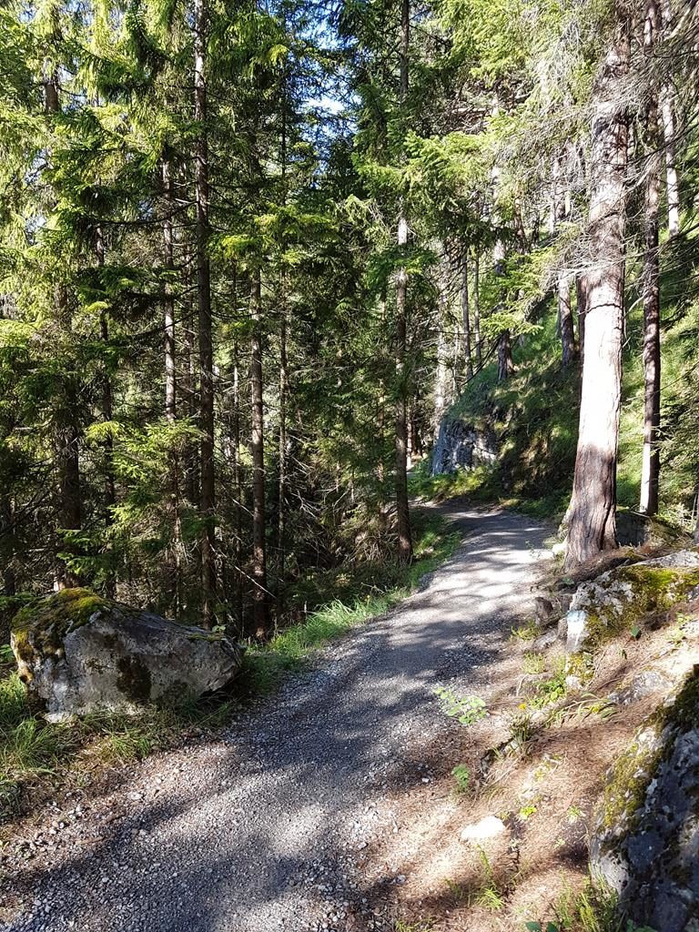 their heavily potholed and broken surface twists steeply up and around a couple of hill tops. A Latvian racer passes me and we chat for a short while. The reason I remember the racer’s nationality so clearly is that we talked about Marians Pahars – a much celebrated former striker for my football club, Saints. But in hindsight, I now have some doubt over my earlier recollection of the hotel workers being Latvian – crossed brain wires seems more likely.
Holtzleiten, 880km – 9:55AM (race clock 03d // 11H // 55M)
Eventually, the hilltops are done, the lane curves right, and I can rejoin the main road. Except I can’t – or rather I don’t want too. Maybe the forest tracks have lowered my tolerance, but it still seems way too busy with fast moving traffic and trucks. Now I’m starting panic – one diversion today was OK, but if the whole of my crossing of the Alps goes this way I could be in real trouble. I walk back to scan a big map board behind me. It seems to show some more lanes and forest tracks that lead to towns in the bottom of the valley. I’m stood by the entrance of a hotel, and decide that some tea and a chair will be a much better way to study maps and route options.
It’s yet another rather-too-smart establishment for my shabby state of being so, after finding a waiter, I hide myself away in a corner on the deck outside. I make a rather surprising discover whilst there too – having completely failed to order anything like English Tea, I find that I actually really enjoy Green Tea. My route planning is a little less definitive – I have a vague notion of what might be possible as I kit up and ride out, but it’s more of a sketch than a plan. As I pass the main road junction two other cyclists ride up to the junction, look at the traffic, and turnaround. Which does at least make me feel that I’m not being ridiculously over cautious by not wanting to ride it.
Left, around the corner, there’s a tiny village – no more than a handful of houses. I try one route idea, but it reaches a farm gate with a trail beyond that has no markings or signs of being for public use. As I do so, a group of maybe 15 mountain bike riders on a tour also reach the same point. Both of us then circle to the other side of the village, and then back to this same point again. The proper route is really not clear. Eventually, at the same time, we all decide the far side of the the village is correct and head that way. No sooner have we done this than we spy the first of the cyclepath signs – we have found the track. The leader of the group looks at me and the bike, and says I’m welcome to follow them but he’s not sure my bike will make it. I struggle not to laugh out loud. They’re clearly almost as lost as I am, and have far less in the way of navigation aids on their bikes. It doesn’t look like they’ve bashed down some serious single track today either. It’d be rude to say any of this, so I just point out that the race I am on requires me to ride alone, and I push on at my own pace.
The next hour is as delightful as the VIA. I traverse what seem to be several inter-connected local cycle routes. At points, these peel off and descend into a succession of nearby towns. But I really want to avoid getting back to the main road too soon. In the bottom of the valley, my route would have split off the main road anyway. So the closer I can get to that point, the less traffic I’ll need to ride in. I stay left at as many of the junctions as possible, keeping in the forest and avoiding towns on the way down. My pace is rapid, I’m now letting the bike run free on the trails – travelling probably close to the same speed I would on tar. With no traffic and only the occasional other rider or walker to avoid, it’s liberating to be sailing through the trees and alongside fields.
Obermieming, 890km – 11:02AM (race clock 03d // 13H // 02M)
At one stage, I end up back on tar and the road starts to dip down into a town. It doesn’t feel like I’ve got low enough yet though. To my left is a steep bank down to a stream – peering through gaps in the bushes I can just about make out a footbridge below. That feels more like the path I should have been on. Doubling back, I slog up the hot tar slope again and spot the narrow turning which I’d missed. I dive down and over the bridge, it’s a delightful stretch – the woodland has thinned out, and I’m now crossing meadows and through a small patch of vineyards. Sadly though, this is the last of my offroad adventures for the morning. I’ve been offroad for almost 70km, and no part of me wants to be back in traffic. Reluctantly, I roll down the last few meters into the valley and out onto the main road. Directly opposite is a garage – I head for the shade of the forecourt to study my screens and figure out where to pick up my route.
Telfs, 899km – 11:35AM (race clock 03d // 13H // 35M)
I start out left briefly, with the idea of following the dotted blue and black offroad path a little further. But within meters a dose of reality hits me. Enjoyable as the offroad trails have been, they’ve been an expensive use to time – it’s taken me over 8 hours to cover the last 85km. I need to get moving again and swing around back onto the main road. The Wahoo stops it’s angry beeping, and the eTrex map now shows the purple line of my plotted route. At least my navigation aids are happy, even if I’m not. The town center is jammed with vehicles seemingly rushing in at me from all sides. It’s a rude and unpleasant awakening from the quite forest trails I’ve spent the morning enjoying. It’s not at all helped by the searing heat, suddenly more noticeable now I’m surrounded by concrete rather than the cooling shade of a leafy canopy.
A busy road leads me out of town and onto a bridge crossing the river Inn – finally an indication I’m making some progress, Innsbruck is not far along the valley. I’m very glad when the GPS takes me onto quieter suburban streets once over the river . I ride on for a way, but heat and fatigue rapidly begin to sap my energy. The riding is flat and easy but I’m shattered. I need food and to sit out of the heat for a while and cool down. To my left I spot a perfect combination – a cafe for food and drink, and a Spa shop opposite to stock up on supplies. I pull in and grab a table under one of the large, grey parasols.
Polling in Tirol, 909km – 12:10PM (race clock 03d // 14H // 10M)
The pizzas on one of the tables look great, but I’m intrigued by a dish one of the staff is bringing out. In a stumbling mix of my German and the waitress’s English, I figure out it’s the special listed on the blackboard – some variation of Sauerkraut with crackers that look a bit like thick, triangular poppadoms. It’s a bit of an acquired taste, but I love good sauerkraut – my order is placed before I even reach the shady corner table. I’m pretty sure a beer will send me to sleep, so I opt for a Radler (shandy). It’s at least an Austrian bottle cap of sorts, but my idea of beer caps from every country is already looking a bit doubtful. I keep the cap anyway, and enjoy the drink – which has an unusual, and pleasant sharpness. Studying the bottle, I see it’s actually grapefruit rather than lemon Radler – an interesting and highly refreshing twist on the norm. After a large helping of ice cream the fuel tanks are fuel, but the temperature is ridiculous. I swap messages (or maybe it was a call) with Yoli, and ponder the idea of a short sleep and continuing in the evening. The cafe owner squashes the idea though – it seems they are just a restaurant, no rooms of any kind. A trip to the bathroom reveals some very comfortable looking couches in the neat and stylish interior. I consider asking if they’d mind me sleeping on them, but it feels like pushing my luck. Instead, I manage to get their OK for me to snooze on a couple of chairs pushed together outside at my table. It’s not very comfortable, but I do at least doze off for an hour or so.
It’s not at all cooler when I wake up. Still fuzzy-headed from the nap, I’m uncertain of what to do. But as my mind clears I realise that even slow progress in the heat is better than no progress. I kit up, fill up with water, soak my UV arm sleeves, bandanna and jersey, and roll slowly back out onto the road. Once in motion, the riding is considerably more tolerable than I’d expected. The faintest of breezes from my speed just takes enough sting out of the heat. I’m intentionally keeping my effort level low to avoid stressing my system, but on flat ground it’s enough to see me making a decent pace. The valley is narrowing though and, as stunning as the scenery is, the hills closing in to my right are a sign that the easy conditions are not going to last long. Sure enough, in the town of Unterperfuss, the road swings to the right, leaving the river behind as it tracks directly towards the mountains.
My speed drops as I hit the first ramp and the punishing heat immediately returns. It sucks the breath out of me and I literally stall out, unclipping and dismounting before I fall off the bike. I plod slowly up to the dogleg bend ahead, but the idea of walking sits uneasily even with the heat. The final trigger needed to shake me out of myself is a mountain biker who spins slowly past me. She’s got lower gears than I have, and none of my baggage, but she’s battling exactly the same heat. Determined to make progress, I mount up and slog slowly up behind her. I’m not trying to race, or even catch up, but the presence of another rider a few meters up the road is that extra little incentive I need to keep me pushing up the relentless slope. Finally, at a sort of curious U-shaped turning on the right, the hill comes to an end. I realise it’s actually a turning circle so that large vehicles can swing around to turn across the road to the left. With a bus coming rapidly up the hill I decide not to hang around in it. I head across the road onto that left turn and am immediately on a wonderfully quiet, mostly flat rural lane across meadows between the mountains. The bus which passes me soon after is the only traffic I remember seeing.
At the end of the meadow the road pitches up sharply again – the gradient, which feels around 20%, is too much. I accept defeat, and walk up the very short steep stretch, mounting up as soon as it lessens. My mind is crystal clear now about where I am. I know the town of Axams is somewhere on the hill above me – but I’ll skirt around the side of the hill, through Birgitz and then Götzens. Finally, on the dip through Natters the road unfolds and there in front of me is the reason I know this section so well in my mind. I’m on the fast run down to join the Brenner Pass. After Fern Pass, I’m more than a little nervous about what lies ahead. It’s the last climb I need to get across the Alps, and I’ve no idea what I’ll do if it isn’t ride-able.
As the road flattens and I roll out onto the roundabout to join the main road, something completely different catches my eye. High up in the sky, the enormous elevated span of a modern highway soars across the valley. It’s completely engulfed in an enormous dust storm. The wind down at my level is breezy, but up there it must be howling an absolute gale. There’s no avoiding the logic of geography – even though I am far below the enormous concrete flyover, at some point up ahead we are crossing the same hill. Not only do I have to climb up all of those meters separating our two roads, but as I do so I’ll be rising up into that maelstrom. It’s really not worth worrying over now though, and at my concern over the pass seem unfounded. The road is nice and wide, and traffic is very light. I begin the long grind. This is it – one last up and over, and I’ll be in Italy.
Gärberbach, 933km – 3:45PM (race clock 03d // 17H // 45M)
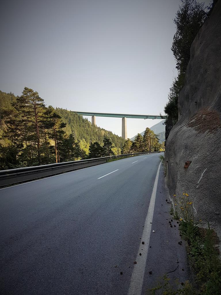 I’d heard people comment that Brenner Pass was their least favourite route to cycle across the Alps, and I could kind of see that. It was mildly scenic, but far from stunning. Visually, the most impressive part was the highway bridge which I stopped to shoot several photos of. There were wooded slopes, meadows, and all of the things one expects of Alpine scenery, but somehow it just didn’t match up to the vistas from earlier in the day. What it lacked in scenic beauty though it made up for by being comfortable riding. The gradient
 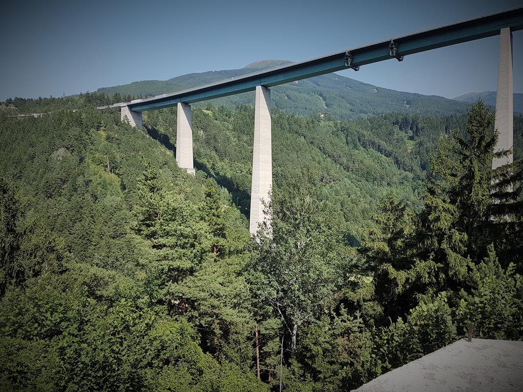 allowed for relatively easy seated spinning – the only times I stood were to stretch my legs out rather than for extra leverage. Even the short stop part way up was more because I needed a pee rather than an actual rest. I watched the wind thrashing wildly through the trees as I sat on a large rock in a gravel turn-off eating a snack bar.
Making my way out onto the road that wind blasted me full force, but by the time the road levelled off the wind’s ferocity had slackened very slightly. It was strong enough still to be annoyance though, slowing my progress along what ought to have been an easy and pretty stretch. The road crossed a large expanse of flat, green, mountain pastures and villages to my left. The main highway was still high up the hillside to my right, but closer than before. As I pushed into the headwind, a familiar face came alongside – it was Isobel again. She’d probably enjoyed way more sleep than I had, but it seemed my diversion around Fern Pass hadn’t in fact altered our road position at all from the previous evening. I remember we rode together for a handful of minutes – commenting on wind, heat, or most likely both before she pulled ahead of me. Or maybe I pulled ahead, I forget which – the former seems more likely though given how wrecked I was. Earlier on the pass I’d spotted a couple of inviting looking guest-houses and considered stopping for food. But midway up the climb seemed a bad place to stop. Now, in the belief I’d crested the pass, the small Kiosk I spot is impossible to resist and I pull in.
Statz, 950km – 5:16PM (race clock 03d // 19H // 16M)
The Kiosk felt dangerous on several levels. First were the comfortable looking couches outside – vacant and begging to be slept on. Next up was the small group of youths at a narrow counter on the deck beside the serving hatch. They didn’t look even remotely menacing, but an exhausted brain casts an odd shade to the simplest of everyday scenes. A middle aged tattooed guy sitting at one end of the group completed what was probably just a fictional picture in my mind of some Alpine chapter of Fagin’s gang. I moved my bike a little closer to the couches just in case. The final danger was the menu – I’m sure somewhere on there were salads and healthy options, but the only things I saw were a comprehensive collection of fried things. Fortunately, in my present state, any of them would have been ideal and I struggled to decide which I fancied most. The cheerful, also tattooed, serving girl even went the extra mile and searched through a collection of colorful packets until she found the last Green Tea sachet in the place. I found out later that my new favourite beverage has a decent amount of caffeine in it, but at that moment it was the flavour I was craving most.
After swapping a chain of messages with Yoli, and devouring the burger I’d opted for, I did put my feet up on the couch and rest for a bit. I was hoping that as evening fell the wind would die down, and at one point it seemed to be obliging. It was just a brief lull though which soon picked up again. I may have been over the Alps, but I still needed to get into Italy before sleeping. Reluctantly I hauled myself up from the comfort of the cushions, and readied to ride on again. Across the road I spotted an odd sight which my brain couldn’t immediately decipher. A procession of cars and trucks crept slowly along at exactly the same speed, their bumpers touching, and some of them facing the wrong direction. It truly was the oddest sight, and only once I’d ridden past the Kiosk’s fence and out to the street could I see the low-load rail trucks they were sitting on. It was an enormously long train ferrying vehicles across the Alps.
The riding was far far harder than I expected. I should have been racing downhill at speed into Italy, or at least flat to the border. Instead I was battling wind, and it felt like I was still going uphill too. It was a harsh slap in the face, and my spirits sank a little. Somewhere, I passed a massive new rail construction crossing high above the road – perhaps the new long distance tunnel under the Alps I remembered reading about. Slowly, as I slogged on, several observations began to gnaw away at me. Firstly, the main highway was still above me. It was of course possible that we were crossing a different point, but road builders generally pick the lowest saddle of a range of peaks for their passage. It was unlikely our elevation at the top would be significantly different. The final piece of the jigsaw though was the river beside me. It was flowing back past me to where I had come from – totally the wrong direction if I was now about to descend out of the hills.
OH CRAP!
I realised I’d made a totally flawed assumption that when the earlier climb flattened out, it was the top of the pass. I hadn’t even bothered to confirm it using the map or route profile. I rode on battered and utterly dejected – this was not the fast, easy downhill I’d been looking forward too, there was yet more climbing to do. The revelation was finally confirmed after maybe half an hour of riding. As a bend opened up in front of me I saw a long steep incline, on top of which my pass and the main highway clearly both crossed through the same narrow gap. That was the top, there ahead. It wasn’t actually a lot more climbing, but the manner in which I’d reached it nearly broke me. Only as I stomped the pedals around the last bend, and drew completely level with the highway did I know for sure I’d crossed the Alps. That elevated span, high up in the clouds and the howling wind, was now just the other side of the Armco barrier beside me. Finally, I could actually celebrate – I may even have let out a little laugh and a cheer.
Brennero (ITALY), 965km – 7:42PM (race clock 03d // 21H // 42M)
I’d seen pictures of the sprawl of outlet stores, so I was prepared for Brennero to feel a little “different“. The sprawl started even before the shops though. From the moment I crested the pass, the character changed into something developed, almost mildly industrial – tarmac everywhere, slip roads, truck stops, railway sidings. It all felt somewhat misplaced, perched on the top of a high Alpine pass. But Brennero is also a border crossing, which is really what accounts for the bleak, faceless, urban landscape. The outlet stores are a leftover from pre-EU days when duty-free existed between European countries. Similarly, the rail and road infrastructure hark back to the times of border control checks. And here I was, rolling silently along into Italy, unnoticed and without so much as reaching for a passport.
The streets are largely deserted as I take the one-way loop around the now closed stores. Another TCR rider is crossing the junction on the far side of town where the two halves meet again – we nod a greeting. He seems to be looking for something – although it’s early to be searching out a hotel. I push on, and as the road leaves town there’s two locals beginning the descent ahead, their kit and bikes both immaculate. My speed picks up rapidly as I charge after them, down the first ramp of the hill. The route alternates between cycle path and road. Even with light traffic, it’s still a fairly major road, and part way down the descent I opt to keep right on a path rather than follow the locals on the road. It’s a true delight – the surface is fast and smooth. There are several tunnels, lined with semi-circles of corrugated-iron and with motion detectors that trigger the lights to blink on as you approach the entrance. I’m enjoying my first taste of Italy’s cycling infrastructure.
I exchange greetings with a group of touring cyclists who are sat on one of the many benches (I have a vague memory they may have been pitching camp for the night). As I pass, I notice the growing altitude between the flat, rightward curve of the path, and the road which is dropping dead straight down into the valley. As pleasant as the path is, it’s slowly heading off in the wrong direction. A junction up ahead has a lane left and down towards the road again. After a couple of surprisingly steep hairpins I’m stood in the middle of a handful of houses. The map shows a dotted path exiting the farm opposite and back to the main road. But it feels like a private track rather than for public use, and it’s not clear that there is any kind of bridge across the stream at the far edge. I decide not to risk an angry farmer or wet feet, and ride back up between the houses. I’m relieved to see a roundabout ahead that leads me back onto my planned route.
VIPITENO, 983km – 8:30PM (race clock 03d // 22H // 30M)
I’m flying along now – it’s pretty much one, long, continuous downhill. There are a couple of tunnels which seem impossible to avoid, but they’re well lit and short. The final tunnel I reach has a side lane around it. Without really noticing it, I pass through the town of Vipiteno. It’s significant for a couple of reasons – it was the town I’d hoped to reach the night before, and also somewhere along here was supposed to be an excellent pizza restaurant that I was looking forward too but never found. I pass through hungry (again), and now a full day behind my schedule, but at least the worst of the hills are behind me and I’m still in shape for making CP2 (Monte Grappa) within cutoff. In the last rays of daylight I join another 2.5km of cyclepath beside the Isarco river. I settle down onto the tri-bars, and enjoy the easy speed – I’m consistently sitting around 35km/h without expending any really effort. The end of the path though sees me lugging the bike down and up steps under the railway line to get across to the road again.
Details of the remainder of my flight along the SS12 are sketchy. I clearly remember riding a completely deserted 3 lane highway in the dark, and weaving under a mass of concrete flyovers. That could well have been around Bressanone (another town I flashed through without really noticing). Although in truth my deserted highway could also have been the next morning. By the time my route leaves the road for cycle path again I’ve been on a near continuous descent for the last 50km. It’s not made up the time lost earlier, but it has at least lifted my spirits and pushed my progress above 200km for the day. The Isarco river is to my left for almost all of the path – I hear it roaring and rushing along beside me as I charge along. The effort of the day is catching up with me though, and my eyelids are starting to sag as the path leads back onto the SS12 again. Ahead is a hotel, something I’ve been hoping to find for the last half hour or so. But pulling up the driveway, it looks rather closed – which is confirmed by staff sat at a table outside. I’m contemplating lying on one of their tables for a sleep when they suggest somewhere back on the route I’ve come down. Reaching the road again, I’m not keen to backtrack so I swing right again out of their drive. I’m beginning to think my dream of pizza and a bed may end up being more like snacks, and a nap on the floor of a garage when the riding angels intervene again. Literally around the next corner is a clearly open establishment that seems to be both a hotel and a pizzeria. Seriously, what are the chances? (I may have said that before!)
COSTE, 1024km – 10:25PM (race clock 04d // 00H // 21M)
The owner doesn’t exactly seem keen to allow my bike in the room – but he’s also not willing to give me a key to the storage room, and eventually gives in to my begging. As he checks me in, I duck into the pizzeria and get a takeaway pizza and a beer ordered. By the time he’s copied my passport, and filled out all his paperwork the smell of pepperoni is wafting up from the box I’m holding, and the beer is already half gone. The pizza doesn’t last much longer – a meagre two slices are left over as I sit on the edge of the bed, feeling very satisfied with my day and my luck! Under the harsh light of the room, my bike in the corner does look rather filthy and I can see why the owner was so reluctant. But not having to unpack is saving me valuable time. I whizz off a few messages to Yoli, before showering and setting the alarm. There’s still around 200km to go, with a stiff climb after Trento, and temperatures forecast to be above 40. Although I should make the 5pm cutoff, there’s no time for a lie-in. It’ll be minimum sleep rations, and another early start. I’m smiling through the pain though as I drift off to sleep. The Alps are done – and the adventure levels have been epic.