Breakfast TV was talking to itself in the background – the news was typically grim and I had more pressing issues on my mind. In between mouthfuls of muesli and swigs of coffee, I was churning over the route down to Land’s End. I’d intentionally followed an off-road section for the last part, but after the heavy rains I was pretty sure it would be even boggier than had been described in accounts I’d read. By the time I was kitted up and ready to go the decision was made, I’d take a largely on road route down and back. This meant an operation I am always loathe to trust a Garmin will do reliably out in the wild: asking it to reverse a track. In theory, it should work with plenty of track points, but in practice it makes me nervous. So I wasn’t entirely confident in the little purple line as I wheeled back down the alley and out into the streets of Truro.
188km – Truro – 06:35
The first section was a nice leg warmer, uphill to the main road and roundabout which flanked the far side of the city. Immediately beyond I was back on pleasant, leafy lanes. Still slippery from the night before they demanded attention as I sped down again. The morning was grey and damp, but not raining, and patches of blue were breaking out ahead. As I rolled across into the next valley, I could see a massive railway viaduct some distance ahead. The Victorian engineers of the GWR (Great Western Railway) certainly knew a thing or two about building an easier route across the undulating landscape. For now though, my nearer point of interest was the first gravel section of the day – a lovely, wiggly waterside path starting in the village of Bissoe. It even threw in some old mining buildings for good measure, and a café – although I was too early for the latter to be open yet.
Had the café been open, my lasting memory of this section would just have been the delightful path – because the occupants would probably have directed me to the proper route just beyond. Instead though, I missed the short climb at the end of the large, muddy coach park. What followed was a few hundred rock strewn meters, wet feet, and a lot of swearing. Eventually, an escape route appeared back up a slippery bank to the proper path I had missed. Looking back I could see how much nicer, and faster it would have been.

In theory, parts of my route here and later in the day would be on the NCN 3, but not all of the time, meaning I couldn’t just blindly follow the occasional signs. Not that it would have made any difference at the end of the smooth tarmac path. I didn’t actually spot the sign which should have taken me left off the short stretch of road and onto more gravel trail. Instead, I followed my plotted route, which started out OK, although a little bumpy on the unmade road. At Hale Mills though, things went properly pear shaped. I found myself in the bottom of a quarry, staring at several not very appealing options. The first was an awkward looking narrow concrete beam, which may or may not have been a bridge. I decided the option of drowning in a pool of dirty mining water before I’d had my second breakfast didn’t sound fun. There was a possible second option along that way, but it was footpath not cycle path. The third, which I took out of hope more than expectation, did actually have a cycle sign up it – albeit a MTB sign. Which, it very definitely was. Steep, narrow, rutted, boggy clay – in fact everything a good bit of single track needs to be a fine blast down on a light full-sus machine. Hiking back up it with a touring rig, even if a couple of kilos lighter than normal, was a bit less than fun. I hadn’t covered 10km of my “easier, faster day”, and I was wandering lost in a quarry with who knows what dangers lurking. And it was raining again.


The problem now was getting myself unlost. A task that was made worse by an incorrect assumption which would plague my progress for the next couple of hours. I believed a rookie mistake of trying the “reverse route” option had led me to this point. In fact, as I would only realise much later in the day, my rookie mistake was made weeks before back at home. I had not zoomed in enough to carefully inspect this section of the route. A fatal mistake, especially on offroad sections. The planning software had routed me on a bike track, just not the one I was aiming for. The NCN 3 ran parallel to me, less than 300 metres away, but it was only when I spotted another gravel bike riding along on it through the bushes that I realised where I needed to be. Eventually (after a lot more slipping and sliding in clay, bumping over rocks, and splooshing through massive puddles that I worried may disappear into some bottomless mine shaft) I got back onto the proper trail. Which was, of course, lovely. Unlike my mood, and the state of my shoes and socks.
When I finally exited the trail back onto road, I’d covered 16km in an hour and a half. Not the start I had hoped for, but worse than this was my total lack of confidence now in the track showing on the Garmin screen. I followed it, because there was no other option, but it was only the handful of NCN 3 signposts that gave me any conviction over my direction. Beyond hunger, or dehydration, self-doubt is probably the worst enemy of any long distance cyclist. And I was now hauling bag loads of it. At least the route was scenic and challenging enough to give my mind something else to focus on. The railway track may have been able to take the easy route, but I had to get up and over the steep ridge before rolling down into Redruth.
206km – Redruth – 08:30 (3,341m)
Places were beginning to open as I rolled through, and it was tempting to stop for breakfast, but with less than 20km on the log for the day, I really didn’t feel like wasting time. I wanted to get within sight of the coast before stopping. Rolling on, I passed almost underneath the monumental arches of the viaduct I’d seen earlier, before swinging off and slogging back up out of the valley again. When I reached the top, there was the railway again, with a few morning trains thundering past. I was also now on easier riding, a pleasant cycle path running parallel to the railway across meadows and through woods, with mine workings dotted either side. At last, some faster, easier riding. Shortly after the level crossing in Camborne though, my progress was slowed again. I became conflicted between the Garmin route and the NCN 3 signs. Opting to follow the latter proved a mistake, as they ran out part way through town, causing me to manually navigate my way back to the purple line on screen which I should have just followed in the first place. I was getting frustrated with myself for messing around so much, but the original source of my error still hadn’t occurred to me, and so I still didn’t trust the Garmin route. It took another mistake, 3 or 4km further long to finally set me straight.
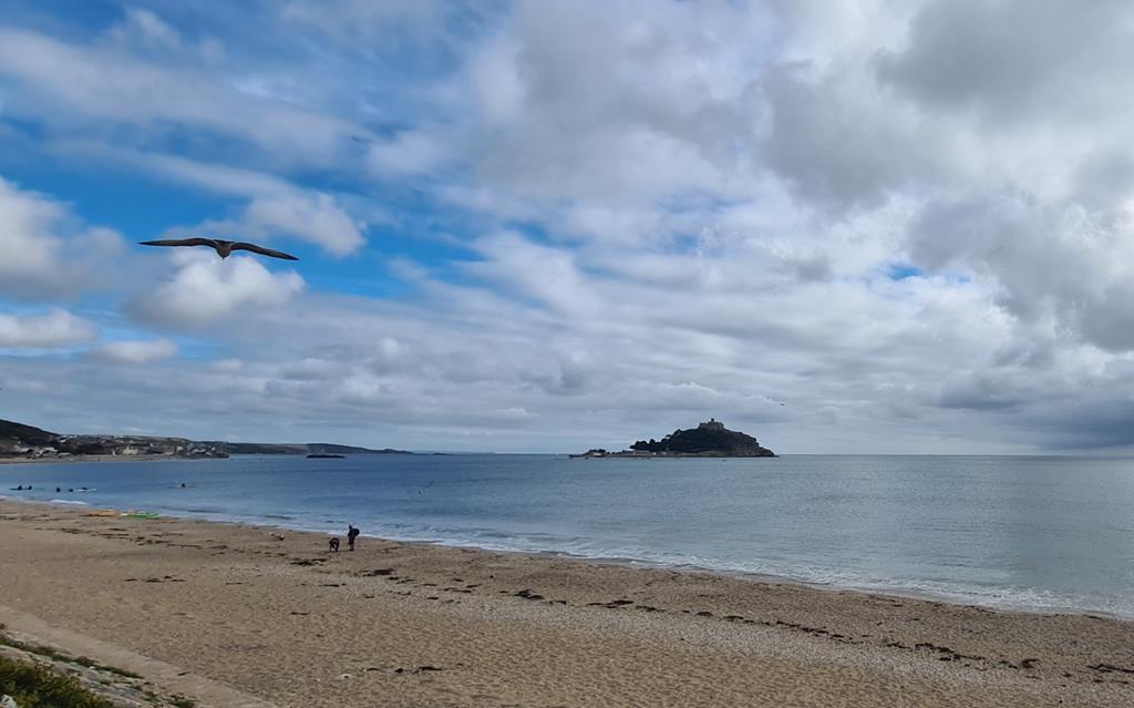
At Carnhell Green, I once again chose the NCN 3 over the plotted route. But around 2km further along, a nagging doubt crept into my mind. I remembered that the NCN 3 took a needless northward loop through Hayle. Not much out of my way, but still several kilometres further than needed. And then it dawned on me – the “reverse route” was not leading me astray at all, I must have plotted the original route badly back at home. I zoomed out the Garmin screen, swung around, and piloted myself along a parallel route to the visible track until I rejoined it at Fraddam. At last I was certain of my direction, and could put foot down to the coast. My progress instantly became more rapid. Apart from a short ramp up, and through the quaint looking village of St Erth, I was flying along an almost entirely downhill stretch. In no time, I started to see glimpses of sea through gaps in the hills, and finally, the most welcome sight of all – the unmistakeable outline of St Michaels Mount. I sped down to it, grabbing a quick photo before heading off along the seafront towards Penzance and the prospect of breakfast.


That prospect had to wait a little longer than expected. By the time I reached the red PATH CLOSED sign, the café I had passed earlier was too far behind to consider going back too. But the only way forward, was down a rocky staircase and along the beach for a few hundred metres to some more rocks, that I could scramble up and get back onto a road. The last thing I had expected today was a hike along a sandy beach. The cycle path should have provided a safe, scenic ride along the shore into Penzance. Instead, I was diverted onto an awkward mix of the busy dual carriageway of the A30,and pavements alongside it. A perfect example of cycle paths in the UK. Great in theory – the planners had mapped out a wonderful sea wall path. But in practice – no one had suggested to those building it, that a temporary alternative to riding along the A30 might be a good idea. All of the miles of paths would be so much better if they joined up, and were well maintained after being built. The traffic wasn’t about to dent my mood though – breakfast was just up ahead, at a harbourside café next to the station which marked the very end of the GWR line.
240km – Penzance – 10:45 (3,742m)
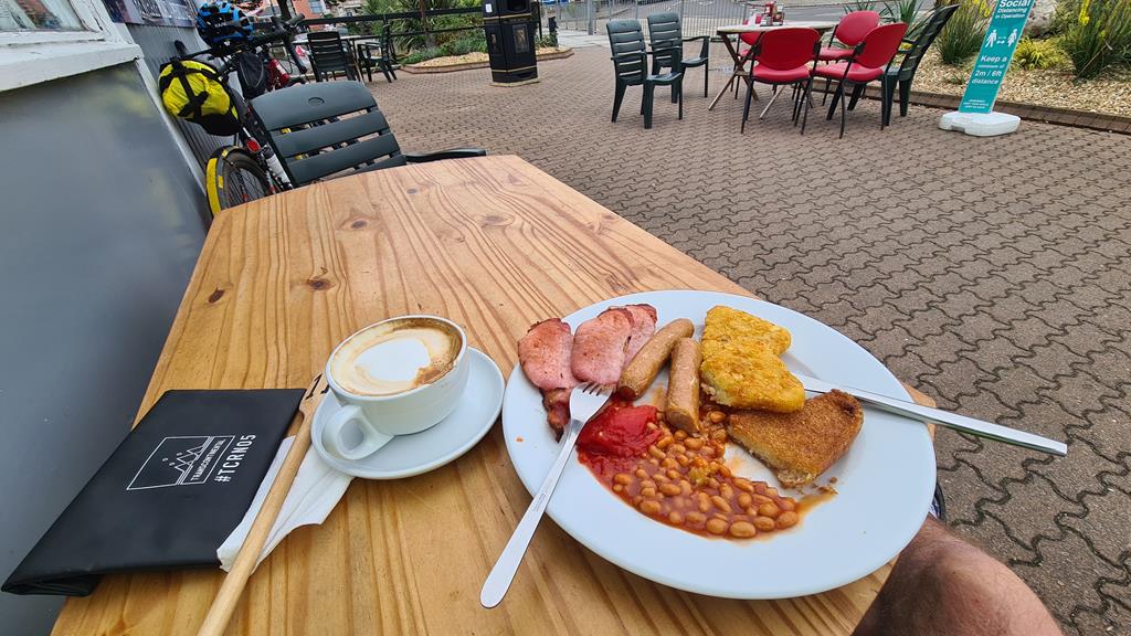
And what a breakfast it was. An plateful of everything good about an English cooked breakfast, washed down by a decent coffee or two as well. And in good company too, rather surprisingly. As I was parking up my bike and heading in I struck up conversation with a MTBer who, despite the lack of bags, had the appearance of also being on a tour. We shared a table as we enjoyed the fare. I learnt he was camping up on the North coast at Hayle, and out for a day ride down to the South coast and back. We chatted about bikes, touring, routes and probably a ton of other stuff that is now lost on me before eventually we both realised we needed to push on with our rides. The stop had been just what I needed both physically and mentally though. Riding along the seafront and out of town, the skies cleared and sun shone down. My mood had swung a full 180, and I was back to enjoying some glorious riding again.
240km – Penzance – 11:30
The sea front was bustling with life, and the road between the cafes and harbour was busy with drivers who’s attention was clearly distracted by the hunt for a parking. Anticipating and dodging their erratic manoeuvres required my full attention. Progress wasn’t fast, but I wasn’t in the least bit bothered. The sun was out, and rolling slowly through suburbs strung along the beach was delightful. The tide was out as I crossed the small swing bridge at the far end of town, yachts and fishing boats propped up or leaning on the exposed sand flats. The road took a sharp right just beyond and ran along through Wherrytown and on to the impossibly pretty fishing village of Newlyn. It was obvious from the landscape what lay in wait somewhere ahead – the leisurely jaunt at sea level was going to end, and I’d need to haul myself up and over the cliffs to my right. This happened in Mousehole a couple of kilometres further along. Whether or not I’d have managed to pedal the full length of the 16% gradient I’ll never know. A combination of cars and lorries trying to scrape past each other left me no chance of keeping enough momentum to balance on the steep and narrow cobbled street.
At the foot of the country though, the landscape may pitch and roll, but there isn’t high enough ground to generate any serious climbs. Sharp and painful yes, long suffering slogs no. Once up the short haul out of Mousehole I zig-zagged across mud strewn lanes (at least I told myself it was mud, although most of it smelt like something worse had been dragged by tractors from the neighbouring fields). I made a mental note to clean my water bottle top before each swig and avoid as much contact when drinking as possible. It wasn’t the country smells that convinced me not to ride back this way though, it was the ugly descent into Lamona. My legs just didn’t fancy the even uglier reverse climb back out. I had a good look at the backward direction of the main road as I swung onto it. It was also uphill, of course, but much more gentle. Even with traffic, it should be fine.
The route I’d planned to the end of the land took me left off the main road soon after and through the town of St Buryan. For some reason, this was the point at which the blindingly obvious struck me – this journey isn’t called The Saints Way without reason. St Erth and St Buryan were just a couple of recent names that came to mind, but I knew I’d passed many more. I wondered about the proximity of each to nearby sites with a more ancient druidic or perhaps celtic origin – just a couple of kilometres back before leaving the main road, I’d passed signs to 3 sites: a burial chamber, a stone circle, and a wayside cross. I wondered how much of the Saints Way was actually an early process of converting the older faiths by embracing and re-purposing their own sacred sites.
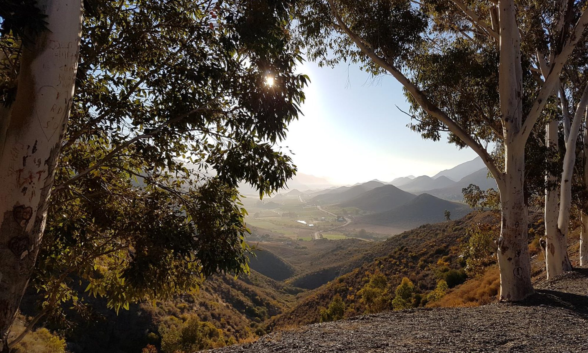
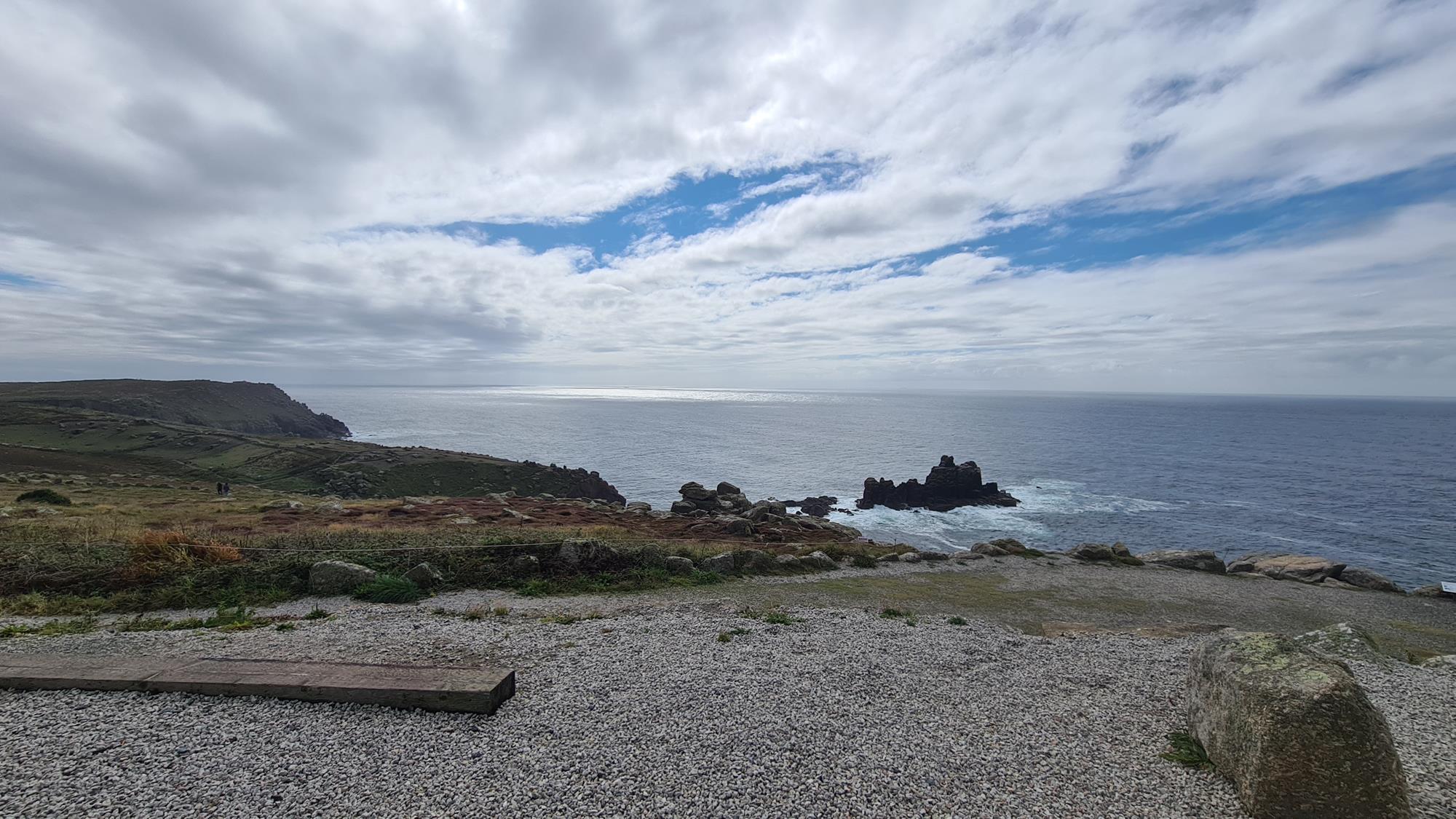
The bike rolled onward seemingly under its own power now. My mind was deep in thought, and it didn’t really need me. I could gaze out at sea views in front, and to the left and right of me. The terrain shrunk to a narrow point clearly up ahead, beyond which there was nowhere further to ride. Apart from propelling the pedals, my presence wasn’t really needed. It wasn’t all downhill, in fact the lane continued to roll up and down significantly, but by now the legs had this without requiring any attention. I sat up and just took in the dramatic scenery. The smile which spread across my face and the laughter which followed was involuntary. As well as reaching my destination for this tour, a longer journey that began 13 months ago was about to end – literally – where the land ended.
267km – Land’s End – 13:10 (4,087m)
After a brief, bumpy section of pleasant cycle path around Sennen Cove, the route ended at what is possibly the most disappointing natural landmark in the country. Man’s presence and influence here is not a good one – an incongruous excretion on what should be a serene and thoughtful place. Not only do the cluster of buildings feel out of place with the location, they manage the impressive feat of feeling out of place with each other. There are some nice places for a coffee, a meal, or a beer – all of which you might expect at such a spot. But jarring alongside them is the bizarrely out of place sensation of being at a second rate theme park of amusement arcades. And if that isn’t your bag, why not have your wedding reception here and get married with your names attached to the sign post (as was in fact happening when I first arrived). Or, if you’re not the marrying kind, just pay someone to take your photo by the sign anyway. At the age of 57, I’m aware of how much I’m starting to sound like my father (or just any other grumpy old man). The turning point of my journey was the sort of place he’d have hated – and my view of it was only marginally better. Improved by a decent cup of tea and carrot cake, and the inner satisfaction of a destination reached. Luckily, this isn’t the first time I’d visited, and I hadn’t expected much. If anything, it was less horrendous than I remembered. I parked my prejudices, and joined the rest of the crowd grabbing snaps and making a mental note that Sennen Cove was the prettier spot to linger if I came down this way again.


267km – Land’s End – 13:35
The impromptu decision to skip the Lamona turn on the way back and stay on the B3315 to Penzance proved a good one. I was back crossing the small harbour bridge in no time, although the boats were now bobbing playfully on the rising tide. I contemplated stopping at one of the harbour side cafés for some proper food, but decided to push on to the small establishment I’d spotted at the start of seawall path earlier in the morning. I remembered seeing a sign for coffee and pasties, and it had views out to St Michaels mount to enjoy them by. Getting there involved reversing the less than pleasant stretch of A30 again, but in truth it wasn’t that bad, or that slow and I was pulling into the car park for food in no time.
291km – Jordan’s Café, Marazion Beach – 15:10 (4,377m)
The tables were busy, so whilst my food was being prepared, I asked a couple if I could share a corner of theirs. One of the benefits of riding solo is it’s much easier to find a space than for a group. As I sat and stuffed my face, I struck up conversation with the couple – they were both dressed in leathers, and were clearly two of the many bikers out for the day. Although it turned out they’d already had their ride for the day – a poorly timed, soaking journey to Redruth. A few clouds were now scudding along the shore, but the weather was still pleasant here. We both remarked that inland around Truro seemed to have its own, much wetter, micro climate. Even as we spoke, the skies looked dark and foreboding in the direction I’d be heading soon. I quickly finished off the veggie pasty (all they had left, but very tasty and more than adequate for my needs), the can of juice, and the coffee. I wanted to be back at the B&B before dark, which should be doable. But I’d also rather do so in the dry, which seemed less than certain. Especially given my morning’s slow progress across this section. And this direction felt as if it was mostly uphill (although according to the hill profile it isn’t).
291km – Jordan’s Café, Marazion Beach – 15:35
The climb up from the coast began soon after leaving the main road and heading inland at Marazion. But the gradients were gradual, even enjoyable. Made more so by the conditions – as I headed steadily back up towards Redruth, the weather seemed to be improving rather than worsening. As I pushed northwards, I seemed to be towing the blue skies from the coast with me. I was sorely tempted to stop for a beer or a snack in St Erth, but I knew danger lay this way – it’s all too easy to slip into a mode where you pull into every nice looking café, and suddenly you’re stopping more than riding.
The streets of the village rose sharply once across the River Hayle – this was where the climbing back up towards Redruth began in earnest. A few flat sections saw me in easier gears, but for much of the time I was spinning on my biggest rear cogs. Beyond Leedstown, I left the main road to pick up the route I’d missed on my way down earlier. I wished I hadn’t though. It was a murderously pot-holed lane, only becoming gravel towards the top end. Even then, it was rough lumpy gravel of large, uneven stones. Not especially easy or pleasant riding. When I did emerge onto a proper lane, the route marker pointed across the lane to more of the same. I’m not sure if I uttered the words “fuck that” out loud or just thought them, but either way I was not in the mood. Ignoring the insistent purple line, I swung left onto a decent riding surface instead. It soon led back to somewhere I recognised – the Carnhell Green detour from earlier. It was easy to backtrack into Camborne from here.
I was through the town quickly, back on the cycle path traversing the old mine works strewn hillside before dipping down into Redruth, and up the steep slog back out of the town. Somewhere along the way I was stopped for a GWR express train at a level crossing, and what I suspected was the same train was perched high up on the massive stone viaduct as I wound under its huge arches for the second time today. My mood was lifted so much by the stunning late afternoon riding that I even began to wonder what the proper route through the quarry from earlier would have looked like. Much to my surprise, I found myself leaving the road to find out. Even without a GPS track, it wasn’t difficult to navigate by paying attention to the mixture of NCN3 and other cycle trail signs. The quarry section itself was bumpy and rough, but perfectly rideable even on 32mm semi-gravel tyres. I’d probably have been annoyed with myself for making such a mess of navigating this section earlier, but the glorious scenery dappled in the evening sunlight was far too enjoyable for such recriminations. The correct NCN3 route dropped back into the coach park after an easily rideable trail, but sadly the bike stop café was closed. A beer here would have topped off the day perfectly. Instead I pushed on up the last few ramps, wiggled around the last few fields, and was back in Truro before the sun set fully.
338km – Truro – 19:15 (5,093m)
I did contemplate going back out somewhere for a beer – but the shower and bed were way too tempting. I knew tomorrow was going to be a long, tough day and I wanted to be underway at first light. So my last freeze dried dinner came out, and the TV went on for some mindless “entertainment”. I wasn’t really watching though. I was contemplating my route for tomorrow. In theory, I would be winding back along the coast, including a couple of harbour crossings by ferry. But, unusually for me, I was feeling rather unadventurous. Everywhere I had touched the coast today had been much busier with traffic and holiday makers than I’d expected. And tomorrow was Sunday, so it’d likely be worse. As much as the idea of a different route home appealed, I really didn’t fancy a painful and risky slog along roads crowded with traffic. Not to mention a potentially long wait for the second of the required ferries across Plymouth harbour (the first would be early enough to avoid any queues). As sleep set in, I’d reached a decision – I’d take the “safe” option of backtracking my route across the moors instead. Only this time, I had confidence the “reverse route” process would not be leading me into some dark, watery hole.